


Le lac de Léat

Vox463
User
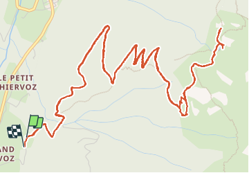

Length
12.2 km

Max alt
1776 m

Uphill gradient
770 m
Km-Effort
23 km

Min alt
1045 m

Downhill gradient
781 m
Boucle
Yes
Creation date :
2023-08-11 07:49:56.0
Updated on :
2023-08-11 15:46:00.804
6h43
Difficulty : Difficult

FREE GPS app for hiking
 SityTrail
IGN / Geographical institutes
SityTrail Plus
The world is yours!
About
Trail Walking of 12.2 km to be discovered at Auvergne-Rhône-Alpes, Isère, Le Haut-Bréda. This trail is proposed by Vox463.
Positioning
Country:
France
Region :
Auvergne-Rhône-Alpes
Department/Province :
Isère
Municipality :
Le Haut-Bréda
Location:
La Ferrière
Start:(Dec)
Start:(UTM)
271422 ; 5021244 (32T) N.
Comments